
San Vicente Reservoir water level
▼ 15.3 points from 52.1% a year ago
Source: waterdata.usgs.gov/monitoring-location/USGS-11022100, accessed October 1, 2026. Updated every 6 hours.
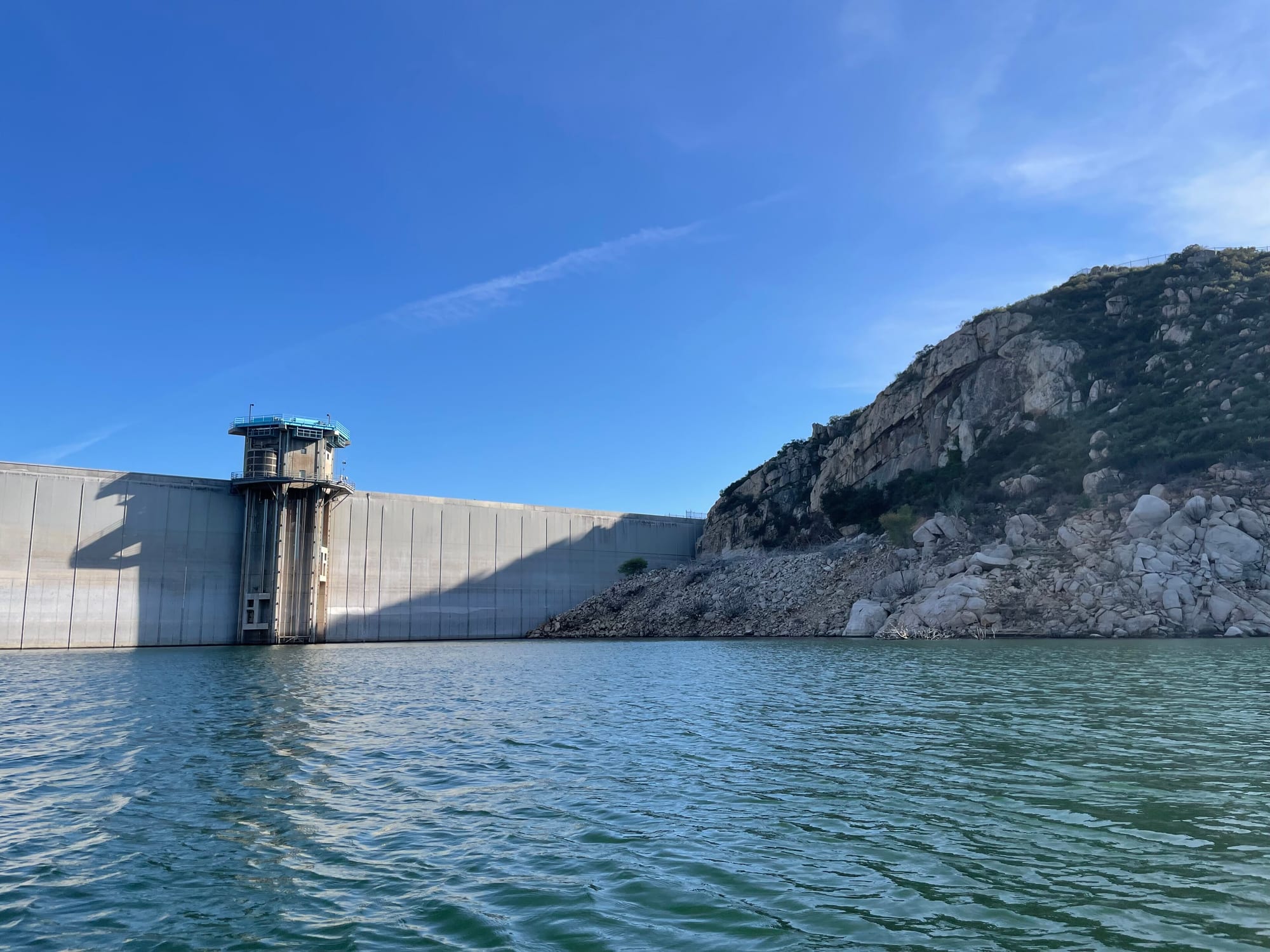
San Vicente Reservoir is at 36.9% of full pool (654.11 ft) as of September 29, 2026. San Vicente Reservoir is near Lakeside, California. It has restrooms, picnic area, boat launch, and marina, managed by City of San Diego Public Utilities Department. Check current swimming advisories at San Vicente Reservoir hours and rules (City of San Diego) before you go.
San Vicente Reservoir level history
This site counts a reservoir as full on a day its storage is at or above 95% of the dam's normal storage (National Inventory of Dams). Many reservoirs rarely reach 100%, even in wet years, because operators release water for irrigation, power or flood control before they fill, so this site treats 95% as full. Highs and lows are daily readings in the published data, not official records. Source: USGS daily data.
Storage, % of full pool, since 1987
San Vicente Reservoir is falling: 37% full, down 0.6 percentage points since September 27, 2026.
On this same date last year (September 28, 2025), San Vicente Reservoir was 52.1% full, 15.1 percentage points higher than today's 37%.
Weekly averages of the source's daily readings; older years may be monthly or sparser where that is all the source published. Download the charted data (JSON).
San Vicente Reservoir map
San Vicente Reservoir is at 32.9134, -116.9281. Open in OpenStreetMap.
The dam
- Water supply
Sources: nid.sec.usace.army.mil, accessed September 29, 2026
Visiting San Vicente Reservoir
- Restrooms
- Picnic area
- Boat launch
- Marina
No camping.
Leashed dogs allowed; dogs must stay at least 50 feet from the water and are not permitted on any vessel.
Good to know:
- Drinking-water reservoir: swimming, wading, bathing, and diving are prohibited. Water-contact sports (waterskiing, wakeboarding, tubing with qualifying PWC) are allowed on posted schedule.
- Cash or check only for permits. Stand-up paddleboards not allowed. Glass containers prohibited.
- Dam raised 117 feet (completed 2016) for emergency/carryover storage; City describes it as its largest reservoir.
Swimming
Designated swim area: Swimming and wading prohibited (drinking-water reservoir); water-contact skiing schedule only.
Water-quality and swimming advisories change without notice. Always check San Vicente Reservoir hours and rules (City of San Diego) before you go.
Sources: sandiego.gov/reservoirs-lakes/san-vicente-reservoir, accessed September 28, 2026
On the water
No campgrounds, boat ramps, or swim spots linked to San Vicente Reservoir yet.
Common questions
- San Vicente Reservoir is at 36.9% of full pool (654.11 ft) as of September 29, 2026.
- San Vicente Reservoir has not been full in the data: its storage never reached 95% of normal storage. This site counts a reservoir as full on a day its storage is at or above 95% of the dam's normal storage (National Inventory of Dams). Many reservoirs rarely reach 100%, even in wet years, because operators release water for irrigation, power or flood control before they fill, so this site treats 95% as full. Based on USGS daily data since October 1, 1987.
- In USGS daily data since October 15, 1987, San Vicente Reservoir's highest elevation was 751.27 ft on May 10, 2024. Its lowest since October 15, 1987 was 587.95 ft on October 8, 2009. These are the highest and lowest daily readings in the published data, not official records.
- San Vicente Reservoir is near Lakeside, California (32.9134, -116.9281).
- Local Government operates the dam at San Vicente Reservoir.
- San Vicente Reservoir's dam is used for Water supply.
- Closed Tue/Wed and the second Friday monthly. Winter: Mon/Thu/Fri fishing/boating; Sat/Sun water contact. Summer: Thu-Sun water contact; Mon fishing/boating. Open major summer holidays; closed Thanksgiving, Christmas, New Year's. Open ½ hour before sunrise to sunset. Fees: General admission adult 16-65 (no water contact; includes fishing permit) $10, General admission youth 8-15 $5, General admission senior 65+ $7, Water-contact fee adult 16+ $8, Water-contact fee youth 8-15 $6, Private boat/craft launch $10.
- San Vicente Reservoir has designated swimming at: Swimming and wading prohibited (drinking-water reservoir); water-contact skiing schedule only. Check current advisories at San Vicente Reservoir hours and rules (City of San Diego) before you go.