
Lake Shasta water level
▼ 5.5 points from 59.4% a year ago
Source: data.usbr.gov/rise/api/catalog-item/10863, accessed October 1, 2026. Updated every 6 hours.
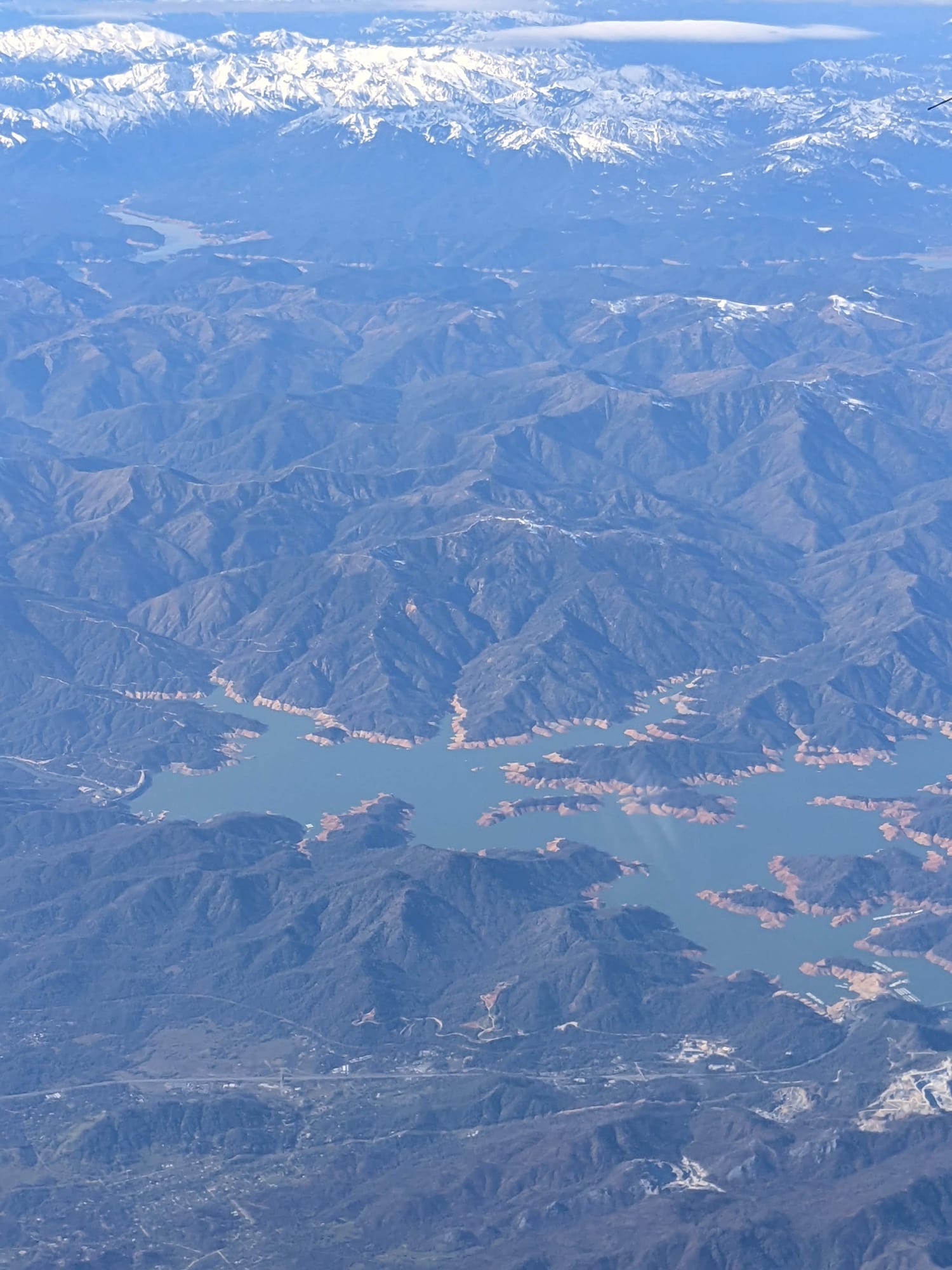
Lake Shasta is at 54% of full pool (982.2 ft) as of September 28, 2026. Full pool elevation is 1067 ft. Lake Shasta was last full on May 12, 2025 (95.2% of normal storage). Lake Shasta is near Shasta Lake, California. It has restrooms, drinking water, picnic area, dump station, boat launch, and marina, managed by USDA Forest Service - Shasta-Trinity National Forest. Check current swimming advisories at Shasta Lake current conditions and alerts (USDA Forest Service) before you go.
Lake Shasta level history
This site counts a reservoir as full on a day its storage is at or above 95% of the dam's normal storage (National Inventory of Dams). Many reservoirs rarely reach 100%, even in wet years, because operators release water for irrigation, power or flood control before they fill, so this site treats 95% as full. Highs and lows are daily readings in the published data, not official records. Source: Bureau of Reclamation daily data.
Storage, % of full pool, since 1944
Lake Shasta is falling: 54% full, down 0.5 percentage points since September 27, 2026.
On this same date last year (September 28, 2025), Lake Shasta was 59.4% full, 5.4 percentage points higher than today's 54%.
Weekly averages of the source's daily readings; older years may be monthly or sparser where that is all the source published. Download the charted data (JSON).
Lake Shasta map
Lake Shasta is at 40.7186, -122.4192. Open in OpenStreetMap.
The dam
- Hydropower
- Irrigation
- Recreation
- Water supply
Sources: nid.sec.usace.army.mil, accessed September 29, 2026
Visiting Shasta Lake (Shasta-Trinity National Recreation Area)
- Restrooms
- Drinking water
- Picnic area
- Dump station
- Boat launch
- Marina
- ADA accessible
Developed campgrounds (single unit: 1 vehicle and 8 people; double: 2 vehicles and up to 16 people) reserve via Recreation.gov; 14-day maximum stay. Shoreline camping areas generally open year-round with chemical toilets; remote Chirpchatter, Madrone, and Deadlun sites are fee-free pack-in/pack-out. Concessionaire: Shasta Recreation Company, 14538 Wonderland Blvd, Redding, CA (530) 275-8113.
Good to know:
- Follow clean, drain, and dry protocol; active mussel-prohibition alerts are posted on the Forest Service Shasta Lake page.
- Public boat launches adjacent to several campgrounds charge a separate daily parking/launch fee (commonly $17).
- Maps: Shasta Lake Unit and Shasta Lake Boating Safety maps are free from the Forest Service website and offices.
Swimming
Water-quality and swimming advisories change without notice. Always check Shasta Lake current conditions and alerts (USDA Forest Service) before you go.
Sources: fs.usda.gov/r05/shasta-trinity/recreation/shasta-lake, accessed September 28, 2026
On the water
No campgrounds, boat ramps, or swim spots linked to Lake Shasta yet.
Common questions
- Lake Shasta is at 54% of full pool (982.2 ft) as of September 28, 2026. Full pool elevation is 1067 ft.
- Lake Shasta was last full on May 12, 2025, when it held 95.2% of its normal storage (elevation 1,059.47 ft). This site counts a reservoir as full on a day its storage is at or above 95% of the dam's normal storage (National Inventory of Dams). Many reservoirs rarely reach 100%, even in wet years, because operators release water for irrigation, power or flood control before they fill, so this site treats 95% as full. Based on Bureau of Reclamation daily data since December 30, 1943.
- In Bureau of Reclamation daily data since December 30, 1943, Lake Shasta's highest elevation was 1,066.94 ft on May 19, 1967. Its lowest after it first filled (April 13, 1952) was 836.68 ft on September 13, 1977. These are the highest and lowest daily readings in the published data, not official records.
- Lake Shasta is near Shasta Lake, California (40.7186, -122.4192).
- Bureau of Reclamation operates the dam at Lake Shasta.
- Lake Shasta's dam is used for Hydropower, Irrigation, Recreation, Water supply.
- Open all year. Developed campground checkout is 2:00 p.m. for family sites; group checkout noon. Fees and operating seasons are subject to change with lake levels. Fees: Day use (selected picnic areas, e.g. Bailey Cove) $13, Boat ramp parking/launch (public launches) $17/day, Developed campground (single site, typical) $30/night, Developed campground (double site, typical) $60/night, Extra vehicle (developed campgrounds) $12/night.
- Shasta Lake Ranger Station, Contact station for current hours; phone listed on forest site.
- Lake Shasta has no designated swim area on record. Check current advisories at Shasta Lake current conditions and alerts (USDA Forest Service) before you go.