
Lake Buchanan water level
Source: waterdata.usgs.gov/monitoring-location/USGS-08148000, accessed October 1, 2026. Updated every 6 hours.
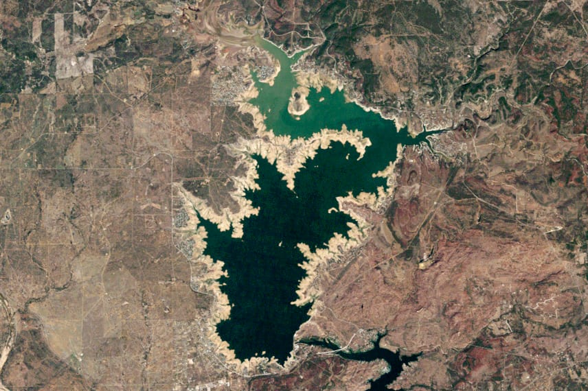
Lake Buchanan's elevation is 1018.28 ft as of September 29, 2026. Lake Buchanan is near Burnet, Texas.
Lake Buchanan level history
Highs and lows are daily readings in the published data, not official records. Source: USGS daily data.
Elevation, ft, past 114 days
Lake Buchanan is falling: 1018.3 ft, down 0.12 ft since September 27, 2026.
Weekly averages of the source's daily readings; older years may be monthly or sparser where that is all the source published. Download the charted data (JSON).
Lake Buchanan map
Lake Buchanan is at 30.7512, -98.4184. Open in OpenStreetMap.
The dam
- Hydropower
- Irrigation
- Water supply
Sources: nid.sec.usace.army.mil, accessed September 29, 2026
On the water
No campgrounds, boat ramps, or swim spots linked to Lake Buchanan yet.
Common questions
- Lake Buchanan's elevation is 1018.28 ft as of September 29, 2026.
- In USGS daily data since June 1, 2026, Lake Buchanan's highest elevation was 1,019.97 ft on June 28, 2026. Its lowest since June 1, 2026 was 1,018.28 ft on September 29, 2026. These are the highest and lowest daily readings in the published data, not official records.
- Lake Buchanan is near Burnet, Texas (30.7512, -98.4184).
- Local Government operates the dam at Lake Buchanan.
- Lake Buchanan's dam is used for Hydropower, Irrigation, Water supply.