
South Fork Reservoir water level
Source: waterdata.usgs.gov/monitoring-location/USGS-10319910, accessed October 1, 2026. Updated every 6 hours.
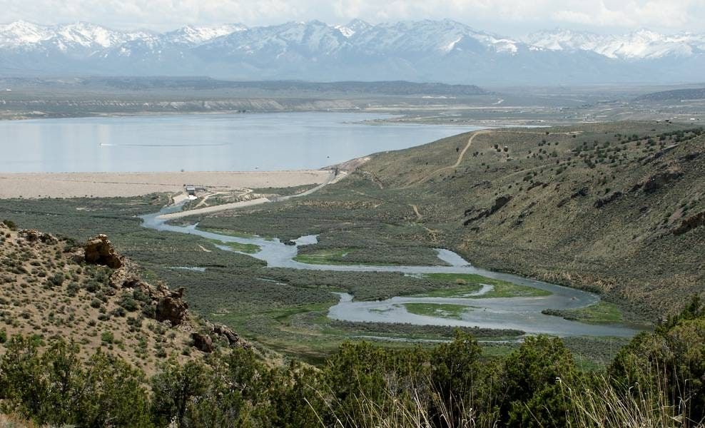
South Fork Reservoir's elevation is 5232.33 ft as of September 29, 2026. South Fork Reservoir is near Spring Creek, Nevada. It has restrooms, showers, picnic area, dump station, and boat launch, managed by Nevada Division of State Parks. Check current swimming advisories at South Fork State Recreation Area current advisories (Nevada State Parks) before you go.
South Fork Reservoir level history
Highs and lows are daily readings in the published data, not official records. Source: USGS daily data.
Elevation, ft, past year
South Fork Reservoir is falling: 5232.34 ft, down 0.08 ft since September 27, 2026.
On this same date last year (September 28, 2025), South Fork Reservoir was 5234.56 ft, 2.22 ft higher than today's 5232.34 ft.
Weekly averages of the source's daily readings; older years may be monthly or sparser where that is all the source published. Download the charted data (JSON).
South Fork Reservoir map
South Fork Reservoir is at 40.6818, -115.7853. Open in OpenStreetMap.
The dam
- Flood control
- Recreation
Sources: nid.sec.usace.army.mil, accessed September 24, 2026
Visiting South Fork State Recreation Area
- Restrooms
- Showers
- Picnic area
- Dump station
- Boat launch
A 25-site campground off the north park access road, with campsite tables, grills, and a flush restroom with showers. East Campground has 6 pull-in sites; its powersites carry a mandatory $10 fee. Open camping along the southwest shore. Group sites at East Campground #1 and #25 and at Tomera Cove. Camping is open all year, 14-day limit per 30-day period.
Leashed pets only, six-foot maximum leash.
Good to know:
- Two boat ramps: a southwest shore ramp that takes boats up to 15 feet, and a main ramp with ample parking and a non-flush restroom. RV dump station open year-round, just off the main north entrance road. Walking trails, no motorized vehicles on them.
- Quiet hours 10 p.m. to 7 a.m.; juvenile curfew 9 p.m.; drones are not allowed; a flat-wake boating zone is in effect in the willows area of the reservoir.
Swimming
Water-quality and swimming advisories change without notice. Always check South Fork State Recreation Area current advisories (Nevada State Parks) before you go.
Sources: parks.nv.gov/parks/south-fork, accessed September 25, 2026
On the water
No campgrounds, boat ramps, or swim spots linked to South Fork Reservoir yet.
Common questions
- South Fork Reservoir's elevation is 5232.33 ft as of September 29, 2026.
- In USGS daily data since January 2, 2025, South Fork Reservoir's highest elevation was 5,236.15 ft on July 15, 2025. Its lowest since January 2, 2025 was 5,232.33 ft on September 29, 2026. These are the highest and lowest daily readings in the published data, not official records.
- South Fork Reservoir is near Spring Creek, Nevada (40.6818, -115.7853).
- State operates the dam at South Fork Reservoir.
- South Fork Reservoir's dam is used for Flood control, Recreation.
- Park always open, seven days a week, 365 days a year. Fees: Day use (Nevada vehicle) $5, Day use (non-Nevada vehicle) $10, Boat launch (Nevada vehicle) $10, Boat launch (non-Nevada vehicle) $15, Camping (Nevada vehicle) $15/night, Camping (non-Nevada vehicle) $20/night, Camp and boat (Nevada vehicle) $20/night, Camp and boat (non-Nevada vehicle) $25/night, Utility hookup +$10/night, Bike-in $2.
- South Fork State Recreation Area ranger station, Monday, Wednesday, Friday, Saturday, and Sunday, 7:30 a.m. to 8:30 a.m.; winter hours Monday through Friday, 7:30 a.m. to 8:30 a.m.
- South Fork Reservoir has no designated swim area on record. Check current advisories at South Fork State Recreation Area current advisories (Nevada State Parks) before you go.